
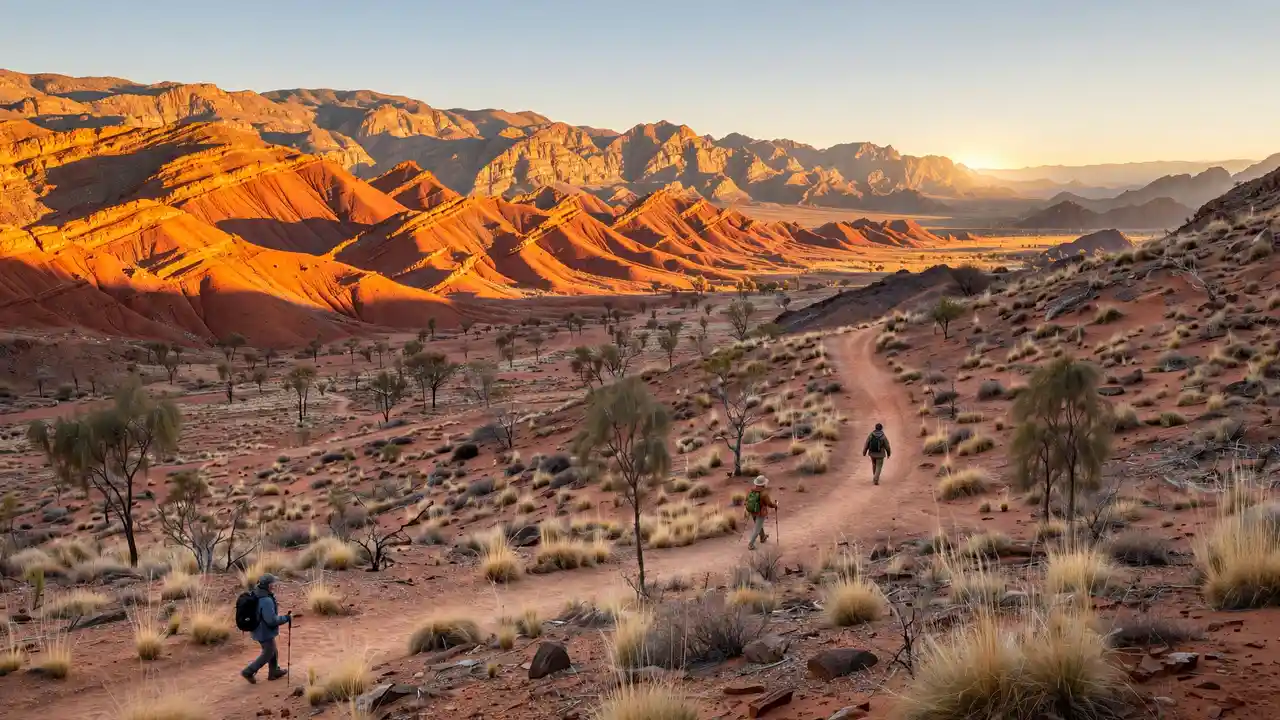
Larapinta Trail: Complete Hiking Guide
The Larapinta Trail is Australia’s greatest long-distance walk. Stretching 223 kilometres through the West MacDonnell Ranges from Alice Springs to Mount Sonder, it crosses 600-million-year-old landscapes — red quartzite ranges, palm-filled gorges, desert waterholes — and finishes with a sunrise climb that walkers talk about for the rest of their lives.
This complete Larapinta Trail hiking guide covers everything: the 12 sections, when to walk, water and food logistics, what to pack, whether to go guided or independent, and how to get there. If the Larapinta is on your list, start here. (For how it compares to the country’s other great walks, see our 20 best hikes in Australia ranking.)
The Trail at a Glance
Distance: 223 km, Alice Springs Telegraph Station to Mount Sonder. Time: 12–14 days end to end (most walkers take 12). Difficulty: moderate to challenging — the terrain isn’t technical, but the distances, heat management and self-sufficiency demand respect. Best months: May to August, when days are mild (low 20s°C) and nights are cold (often below freezing).
The trail is divided into 12 sections, each ending at a trailhead with vehicle access. This makes the Larapinta uniquely flexible: you can walk it end to end, cherry-pick the best sections, or do it as a series of supported day walks.
The 12 Sections
Section 1: Alice Springs Telegraph Station to Simpsons Gap (23.8 km)
The gentle introduction — an easy first day through the foothills to Simpsons Gap, where black-footed rock wallabies emerge at dusk. A good shakedown day.
Section 2: Simpsons Gap to Jay Creek (14.5 km)
Short and scenic, crossing the range via a low saddle. Many walkers combine sections 2 and 3.
Section 3: Jay Creek to Standley Chasm (13.4 km)
Finishes at Standley Chasm (Angkerle Atwatye), the dramatic narrow gorge that glows red at midday. The kiosk here is a welcome sight.
Section 4: Standley Chasm to Birthday Waterhole (16.3 km)
Rugged, remote-feeling walking with some of the trail’s best high viewpoints. Birthday Waterhole is a beautiful camp.
Section 5: Birthday Waterhole to Hugh Gorge (16 km)
The Hugh Gorge junction offers the spectacular (and challenging) side trip up the gorge itself — many rate it the best half-day on the trail.
Section 6: Hugh Gorge to Ellery Creek (26.5 km)
A long day, often split. Ellery Creek Big Hole is one of the finest swimming spots in the Red Centre — deep, clear, surrounded by cliffs.
Section 7: Ellery Creek to Serpentine Gorge (16.2 km)
Shorter, with the Counts Point lookout offering huge views west along the range. Serpentine Gorge’s waterhole is another beauty.
Section 8: Serpentine Gorge to Serpentine Chalet Dam (13.9 km)
A gentler section through open country — a relative rest day.
Section 9: Serpentine Chalet Dam to Ormiston Gorge (27.8 km)
Long and spectacular, crossing the range’s highest trail passes. Ormiston Gorge is the crown jewel of the West MacDonnells — a near-permanent waterhole between towering walls, with the famous ghost gum walk.
Section 10: Ormiston Gorge to Finke River (9.3 km)
Short, via the Ormiston Pound lookout. The Finke River is one of the world’s oldest river systems — around 350 million years old.
Section 11: Finke River to Redbank Gorge (26.4 km)
The long approach to the finale, with big views and the anticipation building. Redbank Gorge camp sits at the foot of Mount Sonder.
Section 12: Redbank Gorge to Mount Sonder (15.7 km return)
The finale: a pre-dawn climb to the 1,380-metre summit of Mount Sonder (Rwetyepme) for sunrise over the desert — the emotional payoff of the entire trail. Then the walk back down, and it’s done.
When to Walk the Larapinta
May to August is the window. June–July offers the coolest walking weather but freezing nights (down to -5°C or colder). May and August–September are warmer but still comfortable. Outside these months, extreme heat makes the trail dangerous — sections close when temperatures are forecast above 40°C, and walking in 35°C+ heat with a full pack is miserable at best. Winter days are typically clear, sunny and in the low 20s — perfect walking weather.
Water: The Critical Logistics
Water defines the Larapinta. Potable water tanks are installed at most trailheads and some campsites, but not all — and they can run dry. The standard approach: carry 3–4 litres per person per day minimum, more on long sections, and plan resupply at the tanks. Many walkers arrange food drops (via commercial operators in Alice Springs) at trailheads like Standley Chasm, Ellery Creek and Ormiston Gorge, which also serve as water top-up points.
Treat or filter water from natural waterholes if you must use them. Never rely on finding water — the tanks are your plan, and everything else is a bonus.
Food Drops and Resupply
Carrying 12+ days of food is impractical, so most end-to-end walkers use food drops. Alice Springs-based operators will deliver sealed, labelled drums to designated trailheads for a fee — typically two or three drops (around Standley Chasm, Ellery Creek/Serpentine, and Ormiston Gorge). Book drops well ahead of peak season. Each drop is also a chance to shed rubbish and pick up fresh supplies.
Guided vs Independent
Guided walks
Several operators run supported Larapinta treks — typically 6-day “highlights” trips covering the best sections, or full 12–14 day end-to-end journeys with vehicle support, meals and guides. The advantages: logistics handled, food and water carried for you, expert interpretation of the landscape and Arrernte culture. The cost is significant, but for many walkers it’s the difference between doing the trail and only dreaming about it.
Independent walking
The trail is well-marked with blue arrows, and experienced, self-sufficient bushwalkers do it independently every season. You’ll need to arrange your own food drops, carry everything, and be comfortable with navigation, first aid and desert safety. The NT Parks and Wildlife Commission publishes detailed trail notes — study them. Independent walking is deeply rewarding but demands genuine competence.
What to Pack
The desert’s huge day-night temperature swing defines the packing list. Essentials: a tent or swag rated for sub-zero nights (or a warm sleeping bag + mat if using the trail’s semi-permanent shelters where available), 3–4+ litres water capacity, sun protection (wide-brim hat, sunscreen, sunglasses), warm layers (down jacket, thermals, beanie, gloves — nights are bitter), sturdy broken-in boots, blister kit, headlamp (for the Mount Sonder dawn climb), and a PLB/EPIRB. The single most common gear failure on the Larapinta is underestimating the cold — walkers pack for “desert” and freeze at night.
Cultural Respect
The Larapinta crosses the traditional lands of the Arrernte people, and many sites are sacred. Stay on the marked trail, don’t enter restricted areas, don’t remove anything, and take time to learn about Arrernte culture — the interpretation signs are excellent, and guided walks include cultural components. This is one of the oldest living cultures on Earth; walk with respect.
Getting There and Away
Fly to Alice Springs (direct from most capitals). The trail starts at the Alice Springs Telegraph Station, a short taxi or bus ride from town. At the western end, Mount Sonder is remote — most walkers arrange a transfer back to Alice Springs (commercial shuttles run in season; book ahead) or get picked up. Allow a buffer day in Alice Springs at each end for gear sorting and recovery.
Training and Fitness
You don’t need to be an athlete, but you do need to be fit. Train with a loaded pack (12–15 kg) on hilly terrain, building to back-to-back long days. Break in your boots thoroughly — blisters end more Larapinta attempts than any other single cause. If you can comfortably walk 20 km with a pack two days running, you’re ready.
Common Mistakes First-Timers Make
The classic Larapinta errors, in order of frequency: underestimating the cold (walkers pack for “desert” and shiver through -5°C nights — bring a proper warm sleeping bag and down jacket); carrying too much water weight between known tanks (study the water notes and carry what you need, not what fear suggests); new boots (break them in for months, not weeks — blisters end more attempts than fitness does); skipping the training (the trail is 223 km, not a weekend amble — train with a loaded pack); and rushing the Mount Sonder dawn climb (leave with generous time; missing sunrise at the summit after 12 days would be heartbreaking).
8-Week Training Plan
Eight weeks out: start walking 8–10 km twice a week with a day pack. Six weeks out: add a loaded pack (start at 8 kg, build to 12–15 kg) and include hills. Four weeks out: back-to-back long days on weekends (15 km Saturday, 12 km Sunday) to simulate multi-day fatigue. Two weeks out: your longest training weekend (20 km with full pack). Final week: taper — short walks, rest, and no new gear. Throughout: wear your trail boots for everything, test your sleep system on at least one overnight, and practise your water and food systems. The goal isn’t just fitness — it’s confidence in your gear and your feet.
After the Trail: Alice Springs Recovery
You’ve walked 223 kilometres — you’ve earned Alice Springs. The town has excellent recovery infrastructure: good restaurants (the Juárez-style Mexican and the fine-dining options are walker favourites), the Olive Pink Botanic Garden for gentle leg-stretching, the Desert Park for the wildlife you were too focused to notice on the trail, and the Todd Mall markets. Most walkers take 2–3 days in Alice before flying out — your body will thank you. And the Araluen Arts Centre’s Aboriginal art collection is world-class; it’s the cultural bookend to the Arrernte country you’ve just walked through.
Larapinta vs Overland: Which Should You Walk?
Australia’s two greatest walks suit different walkers. The Larapinta is a desert walk: dry, sunny, cold nights, big distances, self-sufficient logistics (food drops, water tanks), and ancient red landscapes. The Overland Track (see our Overland planning guide) is an alpine walk: wet, changeable, huts every night, booked departures, and green button-grass wilderness. The Larapinta demands more logistics and heat/cold management; the Overland demands more weather tolerance and mud endurance. Can’t choose? Walk the Larapinta in June–July and the Overland in January–March — the seasons don’t overlap, and many serious walkers do both within a year.
Trail Magic: The Larapinta Community
One of the Larapinta’s underappreciated joys is the trail community. In peak season (June–July), the trailheads and campsites fill with walkers from around the world — and the shared experience of desert walking creates fast bonds. Trail angels (locals who leave water or help with transfers), the commercial food-drop operators who know every walker’s name, and the tradition of the Mount Sonder sunrise shared with strangers who feel like old friends by day 12. Walk in peak season for the social experience; walk in May or September for solitude. Both are valid — just know which you’re choosing.
Frequently Asked Questions
How long does the Larapinta Trail take?
The full 223 km Larapinta Trail takes 12–14 days for most walkers. Fit, experienced hikers sometimes do it in 10–11 days; there’s no prize for speed. Many walkers do selected best sections (5–7 days) rather than the whole trail.
What is the best month to walk the Larapinta Trail?
June and July offer the most reliable cool walking weather, though nights drop below freezing. May and August are also excellent with slightly warmer temperatures. Avoid September–April due to extreme heat.
Do you need a guide for the Larapinta Trail?
No — experienced, self-sufficient bushwalkers walk it independently. But guided walks handle the complex food-drop and water logistics, provide cultural interpretation, and suit those new to desert walking. First-time desert walkers should seriously consider a guided trip.
How much water do you need on the Larapinta Trail?
Plan on 3–4 litres per person per day minimum, more on long or hot sections. Water tanks at trailheads provide resupply points, but they can run dry — never pass a tank without topping up, and carry capacity for the longest dry stretch.
For official trail notes, alerts and booking information, visit the NT Parks and Wildlife Commission, which manages the Larapinta Trail.