
Nullarbor Crossing Guide: Perth to Adelaide Drive
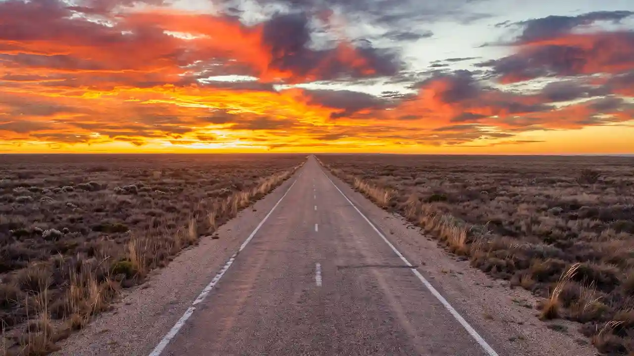
Crossing the Nullarbor is Australia’s great driving rite of passage. The name comes from the Latin for “no trees” — and on the Nullarbor Crossing from Perth to Adelaide, you’ll understand why. Some 1,200 kilometres of the Eyre Highway stretch across the world’s largest single piece of limestone, through a landscape so flat and empty it genuinely messes with your sense of scale.
This guide covers everything: the route, fuel stops and distances, the best time to go, what to see, and the preparation that keeps a legendary trip from becoming a roadside nightmare.
The Route: Perth to Adelaide by Road
The full Perth-to-Adelaide drive is roughly 2,700 kilometres, and the Nullarbor proper — the treeless section — runs from Norseman in Western Australia to Ceduna in South Australia, about 1,200 kilometres. Most people do the crossing in three to four days of driving, though some hammer it in two.
The Eyre Highway is fully sealed and in good condition. It’s a two-lane road with generous overtaking lanes in places, and while it feels remote, it’s one of Australia’s major freight routes — road trains are constant, and you’ll rarely be truly alone. Most travellers are surprised by how good the road surface is; the challenge of the Nullarbor was never the road, but the distance, the weather and the discipline to manage both.
Day-by-Day: A Classic 3-Day Crossing
Day 1: Perth to Norseman (725 km)
The run from Perth to Norseman is a full day through the Wheatbelt — rolling farmland, granite outcrops and the occasional country pub. Norseman is the last proper town before the Nullarbor proper begins. Fuel up, eat well, and check your tyre pressures here.
Day 2: Norseman to Border Village (390 km)
From Norseman the trees thin out fast, and by Balladonia you’re on the Plain. This is the heart of the Nullarbor: the 90 Mile Straight (actually 146.6 kilometres — the longest straight road in Australia), the Madura Pass descent off the escarpment, and the first views of the Great Australian Bight’s towering cliffs. Border Village, straddling the WA/SA border, has fuel, a caravan park and a famously long golf hole (part of the Nullarbor Links course).
Day 3: Border Village to Ceduna (500 km)
The South Australian side brings the Head of the Bight — the whale-watching lookout where southern right whales calve in winter (roughly June to October). The cliffs here are spectacular, dropping 60–100 metres straight into the Southern Ocean. Ceduna marks the end of the Nullarbor; from here it’s green farmland and fishing towns all the way to Adelaide.
Day 4: Ceduna to Adelaide (780 km)
The final leg crosses the top of the Eyre Peninsula, through Port Augusta (fuel, food, the last big town) and down through the wheat and wine country of the Mid North into Adelaide.
Fuel Stops and Distances
Fuel is the number one concern on the Nullarbor, and it’s entirely manageable if you plan. The longest gap between fuel stops on the crossing is around 200 kilometres — well within the range of any standard car. Key stops west to east: Norseman, Balladonia, Caiguna, Cocklebiddy, Madura, Mundrabilla, Eucla, Border Village, Nullarbor Roadhouse, Nundroo, Yalata and Ceduna.
The golden rule: top up at every opportunity, even if you’re at half a tank. Fuel on the Nullarbor costs significantly more than in the cities — budget for it, and remember that headwinds on the westbound crossing can noticeably increase consumption. And if you’re driving anything with less than 500 kilometres of range, carry a jerry can.
The Best Things to See on the Nullarbor
The 90 Mile Straight
Between Balladonia and Caiguna, 146.6 kilometres of dead-straight bitumen. It sounds boring; in person, it’s hypnotic. Set your odometer, take the photo of the sign, and experience one of the great driving oddities of the world.
Head of the Bight
From roughly June to October, southern right whales gather in the sheltered bight below the cliffs to calve. The viewing platform at the Head of the Bight puts you above them. Entry fees apply, and it’s worth every cent — see our whale watching guide for the full seasonal picture.
Bunda Cliffs
The limestone cliffs of the Great Australian Bight run for hundreds of kilometres along the highway’s south side. Several signed lookouts let you stand at the edge of a continent, staring at an ocean that runs uninterrupted to Antarctica.
Nullarbor Links
The world’s longest golf course — 1,365 kilometres, one hole in each town and roadhouse from Ceduna to Kalgoorlie. You don’t need to be a golfer to appreciate the absurdity; playing even a hole or two is a brilliant icebreaker of a story.
Eucla and the Old Telegraph Station
Just east of Eucla, the ruins of the 1877 telegraph station sit half-buried in shifting sand dunes — a genuinely eerie, photogenic piece of colonial history.
Wildlife on the Crossing
The Nullarbor’s wildlife is a highlight and a hazard. Wedge-tailed eagles, emus and camels (feral herds roam the plain) are common sightings. Kangaroos are the danger — they are most active at dawn and dusk, and a roo strike at 110 km/h can total a car. The standing advice from every local: do not drive between dusk and dawn on the Nullarbor. Plan your days so you’re parked up before sunset. Our wildlife spotting guide has more on where to see Australia’s animals safely.
When to Cross the Nullarbor
The best months are roughly April to October. Summer (December to February) brings extreme heat — 40°C-plus days are normal, and a breakdown in that heat is genuinely dangerous. Winter is cooler and brings the whales to the Head of the Bight, though nights drop near freezing. Shoulder seasons (April–May, September–October) offer the best balance of mild weather and long daylight.
What to Pack for the Nullarbor
Essentials
At minimum: 10+ litres of water per person, a full-size spare tyre (plus the tools and knowledge to change it), a tyre repair kit and compressor, sunscreen and hats, warm layers for cold desert nights, and offline maps downloaded before you leave the cities.
Phone coverage and communication
Telstra has the best coverage by far, and even Telstra drops out for long stretches. A satellite communicator or EPIRB/PLB is smart insurance on remote routes. Let someone know your planned stops and check in when you have signal.
Food
Roadhouses sell fuel, basic groceries and hot food at premium prices. Stock up in Perth (or Adelaide) with a cooler, snacks and easy meals — your wallet will thank you.
Costs: What the Crossing Actually Costs
Fuel is the big variable. A standard car doing the 2,700-kilometre Perth–Adelaide run will burn roughly 200–250 litres; with Nullarbor fuel priced well above city rates, budget generously for fuel alone. Accommodation ranges from free rest-area camping and cheap caravan park sites to roadhouse motels. Travelling with your own camping setup and cooking your own food keeps the total very reasonable — it’s one of the cheapest great adventures in the country. If you’re planning to camp, our free camping guide explains the rules that apply along the way.
Nullarbor by Campervan, Car or Motorcycle
Any roadworthy vehicle can cross the Nullarbor — the highway is sealed and well maintained. Campervans are the classic choice, letting you overnight at the many free rest areas along the route. Motorcyclists love the crossing but need to be serious about water, wind and fuel range; the crosswinds off the Bight are no joke. Cyclists do it too, but that’s an expedition, not a holiday — resupply planning is everything.
Common Mistakes to Avoid
Driving at night (wildlife), skipping fuel stops (“I’ll make the next one” — don’t), underestimating the cold (desert nights in winter are bitter), and rushing it. The Nullarbor rewards a slow pace. Stop at the lookouts. Watch the sunset off the Bight cliffs. Talk to the roadhouse characters. This is one of the best road trips in Australia precisely because of its emptiness — don’t treat it as something to get through.
Nullarbor Links: The World’s Longest Golf Course
The Nullarbor Links deserves a fuller mention — it’s genuinely one of the great novelty experiences in Australian travel. Eighteen holes, one in each participating town and roadhouse, stretching 1,365 kilometres from Ceduna in South Australia to Kalgoorlie in Western Australia. Each hole is a par 3 to par 5 with its own character: the famous fourth hole at Border Village is one of the longest in the world, and several holes play across saltbush and red dirt that no golf architect would ever design.
You don’t need to be a golfer — hire clubs are available, the scorecard costs a small fee, and playing a hole or two breaks the drive beautifully. The course raises money for charity and gives roadhouse towns a shared identity. If you play all 18, you get a certificate — and one of the best road trip stories in the country.
A Brief History of the Crossing
The Nullarbor has been crossed for tens of thousands of years — Aboriginal trade routes ran across the plain long before Europeans arrived. The first European crossing was Edward John Eyre in 1841, an epic of suffering that gave the highway its name. The telegraph line followed in 1877 (see the ruins at Eucla), then the Trans-Australian Railway in 1917 — whose 478-kilometre straight section across the plain is the longest straight railway in the world.
The Eyre Highway itself wasn’t fully sealed until 1976 — within living memory, this was a dirt-track adventure. The sealing transformed it into the freight artery it is today, but the romance of the crossing survives: it’s still one of the few places in the developed world where you can drive for hours seeing nothing but horizon.
Photography: Capturing the Nullarbor
The Nullarbor is a photographer’s paradox — how do you photograph emptiness? The answer: scale and light. The Bunda Cliffs at sunrise and sunset, when the low sun ignites the limestone, are the money shots. The 90 Mile Straight sign is obligatory. Road trains kicking up dust at golden hour, wedge-tailed eagles on fence posts, the Eucla telegraph station ruins half-buried in sand, and the night sky — the Nullarbor’s darkness produces Milky Way shots that need no editing. For stargazers, see our dark sky parks guide.
The Time Zone Quirk
Here’s a detail that catches everyone out: the WA/SA border region unofficially observes Central Western Time (UTC+8:45) — 45 minutes ahead of Perth, 45 minutes behind Adelaide. Roadhouses like Border Village and Eucla run on it, and your phone may flip confusingly between time zones. It’s not official, but it’s real — plan fuel stops and closing times accordingly, and enjoy one of Australia’s oddest little anomalies.
Frequently Asked Questions
How long does it take to cross the Nullarbor?
The Nullarbor proper (Norseman to Ceduna, ~1,200 km) takes two comfortable days of driving. The full Perth to Adelaide run is about 2,700 km and takes three to four days at a sensible pace, or two very long days if you push it.
Is there phone reception on the Nullarbor?
Patchy. Telstra has the best coverage with signal at most roadhouses and towns, but there are long dead stretches between them. Other networks have almost nothing. Download offline maps and carry a satellite communicator for emergencies.
Can you cross the Nullarbor in a normal car?
Yes. The Eyre Highway is fully sealed and any roadworthy car can do it. The key requirements are good tyres (including a full-size spare), enough fuel range, and plenty of water — not a 4WD.
What is the longest distance between fuel stops on the Nullarbor?
The longest gap between fuel on the Eyre Highway crossing is around 200 kilometres. Topping up at every roadhouse makes fuel a non-issue for any vehicle with a normal tank.
Check current road conditions before you go at Main Roads Western Australia, which publishes travel maps and alerts for the Eyre Highway.