
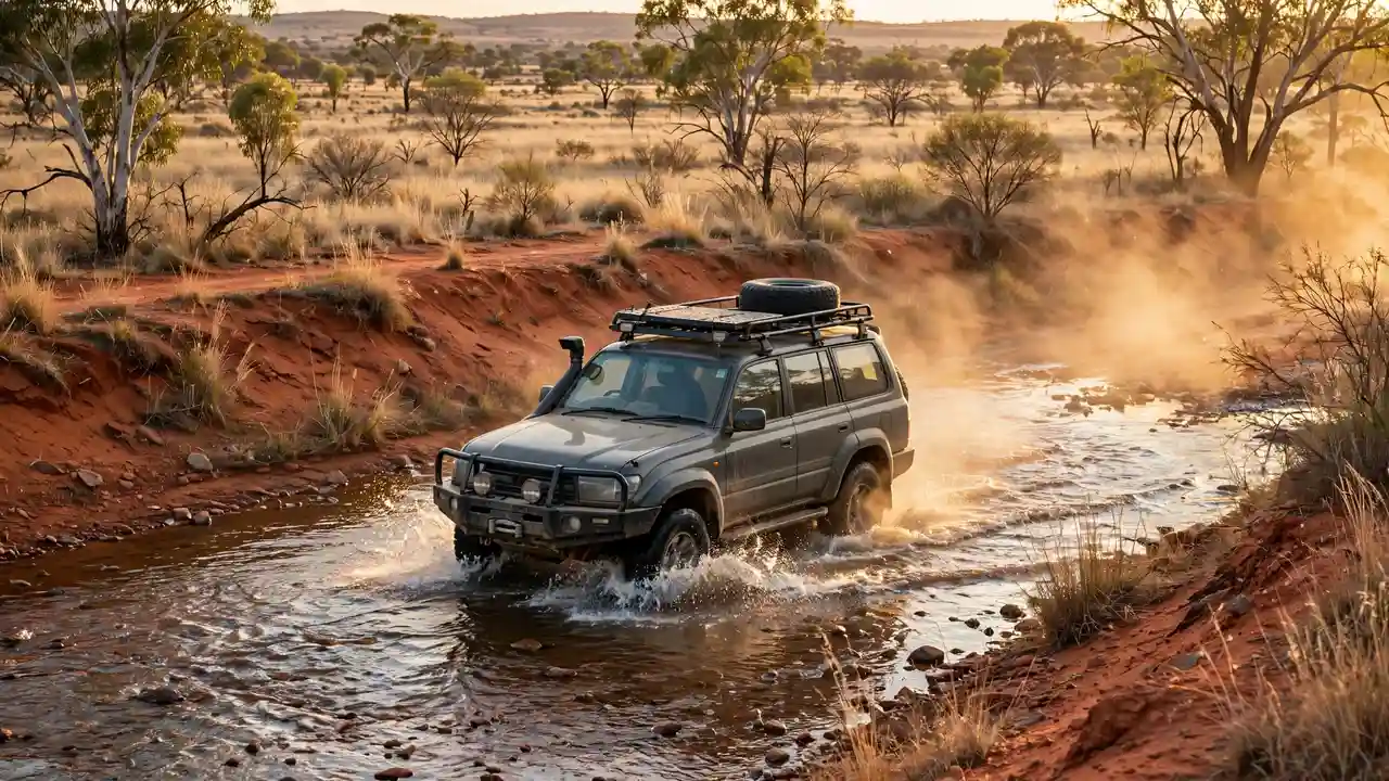
Savannah Way: Cairns to Broome Road Trip
The Savannah Way Cairns to Broome is Australia’s great northern road trip — 3,700 kilometres linking Queensland’s tropical coast to Western Australia’s Kimberley, straight through the Gulf Savannah and the Northern Territory outback. It’s part sealed highway, part remote dirt, and all adventure.
Unlike the sealed Eyre Highway, the Savannah Way still feels like a genuine expedition. You’ll cross rivers, pass through tiny outback towns with one pub and a thousand stories, camp under enormous skies, and drive some of the most remote country in the country. This guide covers the route, the seasons, what vehicle you need, and how to do it properly.
What Is the Savannah Way?
The Savannah Way is a designated touring route, not a single road. It strings together the Gulf Developmental Road, the Barkly and Victoria Highways and the Great Northern Highway into one signed 3,700-kilometre journey from Cairns (Queensland) to Broome (Western Australia), passing through the Northern Territory.
Most of the eastern and western ends are sealed. The middle sections — particularly through the Gulf Savannah between Normanton and Borroloola — include long unsealed stretches that vary from smooth dirt to bone-shaking corrugations depending on the season and recent grading. Conditions change constantly, which is part of the deal.
The Route, Section by Section
Section 1: Cairns to Normanton (Queensland Gulf Savannah)
From Cairns the route climbs the Atherton Tablelands — waterfalls, crater lakes and dairy country — then descends through Georgetown and Croydon (gold-rush history, genuine outback pubs) to Normanton on the Gulf of Carpentaria. Normanton is famous for Krys the Savannah King, a 8.8-metre replica of the largest crocodile ever shot in Australia, and for the historic Gulflander train to Croydon.
Section 2: Normanton to Borroloola (the Gulf)
This is the remote heart of the trip. The road skirts the southern Gulf through Burketown (home of the spectacular morning glory cloud phenomenon in spring) and across the NT border to Borroloola. Fuel stops are few and far apart, the road is largely unsealed, and the fishing in the Gulf rivers is legendary — barramundi country.
Section 3: Borroloola to Katherine (Northern Territory)
North to Mataranka’s thermal springs, then the Stuart Highway to Katherine. Katherine Gorge (Nitmiluk National Park) is one of the great natural sights of the north — take the gorge cruise or canoe it if you’re experienced. This section is sealed highway and easy going.
Section 4: Katherine to Kununurra (Victoria Highway)
West along the Victoria Highway into the east Kimberley. Keep an eye out for the turnoff to the Bungle Bungles (Purnululu National Park) — the beehive domes are a detour you’ll never regret, though the access road is 4WD-only. Kununurra is the adventure capital of the east Kimberley: Lake Argyle, the Ord River and the start of the Gibb River Road turnoff.
Section 5: Kununurra to Broome (the Kimberley coast)
The final stretch along the Great Northern Highway to Broome, with the option of detouring up the Gibb River Road (see below). Broome itself is the perfect finish: Cable Beach sunsets, camel rides, the Staircase to the Moon, and a cold drink after 3,700 kilometres.
How Long Does the Savannah Way Take?
Plan for two to three weeks minimum. The driving alone is 3,700 kilometres, but the whole point is the stops — gorge swims, fishing, national parks, station stays. Rushing it in ten days is possible but joyless. Three weeks lets you take the Bungle Bungles and Gibb River Road detours, which are arguably the best parts of the entire trip.
When to Drive the Savannah Way
The dry season — roughly May to October — is the only sensible window. From November to April, the wet season brings flooding, road closures, extreme humidity and cyclones. Many unsealed sections become impassable, river crossings become dangerous, and some parks close entirely.
Within the dry season, May–June and September–October are the sweet spots: warm days, cool nights, and fewer crowds than the July–August peak. Early in the dry season, waterfalls are still flowing strongly; late in the season, the weather is at its most reliable but the landscape is dustier.
What Vehicle Do You Need?
Honestly? A high-clearance 4WD is strongly recommended. While much of the route is sealed, the unsealed Gulf sections and any detour worth taking (Bungles, Gibb River Road, river crossings) need four-wheel drive, good tyres and recovery gear.
If you’re in a standard 2WD, you can still do the sealed backbone of the route — Cairns to Katherine to Kununurra to Broome — but you’ll miss the Gulf dirt sections and the best detours. Many travellers hire a 4WD camper in Cairns or Darwin for exactly this trip.
Fuel, Water and Supplies
Fuel planning
Fuel stops on the remote sections can be 250–300+ kilometres apart, and outback fuel is expensive. The rule is absolute: fill up at every opportunity, carry at least one jerry can (two if your tank is small), and know your vehicle’s real-world range on dirt — corrugations and soft sand drink fuel.
Water and food
Carry far more water than you think you need — 20 litres per person minimum in the vehicle at all times on the remote sections. Stock up on groceries in Cairns, Katherine and Kununurra; small outback stores have limited stock at high prices. A good 12V fridge is one of the best investments for this trip.
Communication
Phone coverage is minimal to nonexistent across the Gulf and Kimberley sections. Telstra is the only network worth having, and even it vanishes for hundreds of kilometres. A satellite communicator (or at minimum a PLB/EPIRB) is essential safety gear, not optional.
Highlights You Can’t Miss
Undara Volcanic National Park
Near the start of the route on the Atherton Tablelands, Undara’s lava tubes are among the longest in the world. The guided tours are excellent — book ahead in peak season.
The Gulf rivers and barramundi
The rivers of the Gulf Savannah — the Norman, the Flinders, the Gregory — hold monster barramundi. Even if you don’t fish, the river country at places like Burketown is hauntingly beautiful. Take croc safety seriously: no swimming in Gulf rivers, ever.
Mataranka Thermal Pool
A crystal-clear 34°C spring in Elsey National Park — the perfect reset after days of red dust. It gets busy in peak season; go early morning.
Nitmiluk (Katherine) Gorge
Thirteen gorges carved through ancient sandstone. The sunset dinner cruise is a splurge worth taking; the multi-day canoe journeys are for the adventurous.
Purnululu (Bungle Bungles)
The beehive domes of the Bungles are one of Australia’s most extraordinary landscapes. The 53-kilometre access track is 4WD-only and rough — allow a full day minimum, two if you can.
Lake Argyle
Near Kununurra, this vast man-made lake is 18 times the size of Sydney Harbour. Sunset cruises, freshwater crocs, and some of the best swimming in the Kimberley.
Camping on the Savannah Way
Camping is the soul of this trip. National park campgrounds, station stays (working cattle stations that host campers — a uniquely Australian experience), and free bush camps along the route. Book national park sites ahead in the dry-season peak. For the rules on where you can and can’t camp free, read our free camping in Australia guide before you leave.
Safety: The Non-Negotiables
The Savannah Way is remote in a way that demands respect. Never swim in northern rivers or estuaries (saltwater crocodiles are a genuine, lethal risk — this is not an exaggeration). Check road conditions before every remote section; a road that’s fine in the morning can be cut by afternoon rain even in the dry season. Carry a comprehensive first-aid kit, know how to use your recovery gear, and tell someone your itinerary. If you’re new to outback travel, our Nullarbor guide covers the same core preparation principles on a simpler route.
Costs
The Savannah Way isn’t a cheap trip, but it’s not outrageous either. Fuel is the biggest cost — 3,700 kilometres plus detours in a 4WD adds up, especially at outback prices. National park camping fees are modest, station stays are reasonable, and cooking your own food keeps costs down. The paid experiences (gorge cruises, guided tours, fishing charters) are where the budget goes — pick one or two splurges rather than trying to do everything.
Aboriginal Culture on the Savannah Way
The Savannah Way crosses the traditional lands of dozens of Aboriginal nations, and some of the trip’s most meaningful experiences are cultural. The Quinkan rock art galleries near Laura (on the Peninsula Developmental Road detour) are among the finest in Australia — guided tours with traditional owners reveal galleries of extraordinary significance. In the Gulf country, the Burketown and Borroloola regions hold deep cultural landscapes; local art centres (like those in Borroloola and Kununurra’s Waringarri Arts) sell authentic Indigenous art directly from artists.
Approach cultural sites with respect: never enter restricted areas, don’t photograph rock art where signs prohibit it, and take the time to listen. The cultural layer transforms the Savannah Way from a great drive into a profound journey through 60,000+ years of continuous human history.
The Gibb River Road Detour: Should You Add It?
If you’re reaching Kununurra with time to spare, the Gibb River Road is the great “while you’re here” detour — 660 kilometres of 4WD-only track through the heart of the Kimberley, with gorges (Bell, Manning, Galvans), waterfalls and station stays. It adds 5–7 days minimum and requires a well-prepared 4WD, but it’s arguably the finest 4WD track in Australia. The alternative is to save it for a dedicated Kimberley trip. Either way, don’t attempt it without researching current conditions — the road’s state varies enormously through the dry season.
Packing List for the Savannah Way
Beyond the standard outback kit, the Savannah Way demands: serious water capacity (20+ litres in the vehicle), a comprehensive tyre repair kit and compressor (corrugations destroy tyres), a second spare if you’re doing the dirt sections, shade (an awning or tarp — there’s no shade in the Gulf), insect protection (the flies and mosquitoes are legendary — head nets are worth their weight), a well-stocked first-aid kit including snake bandages, and paper maps as backup to digital. A fishing rod earns its place — the Gulf rivers hold barramundi that justify the luggage space. And cash: many remote roadhouses and communities have limited card facilities.
Border Crossings and Quarantine
The Savannah Way crosses two state/territory borders (Queensland–NT, NT–WA), and Western Australia’s biosecurity rules matter: WA has strict quarantine restrictions on bringing certain fruit, vegetables and honey across the border. There are quarantine checkpoints on the highways into WA — declare fresh produce and surrender it if required. Fines for non-compliance are steep. It’s a small detail that catches interstate travellers out; check the current WA quarantine rules before you cross.
Frequently Asked Questions
Can you drive the Savannah Way in a 2WD?
You can drive the sealed sections in a 2WD, but you’ll miss the Gulf dirt sections and the best detours (Bungle Bungles, Gibb River Road). A high-clearance 4WD is strongly recommended for the full experience, and essential in the wet season — which you shouldn’t be driving in anyway.
How long does the Savannah Way take?
Allow two to three weeks minimum for the 3,700 km from Cairns to Broome. Ten days is possible but rushed; three weeks lets you include the Bungle Bungles and Gibb River Road detours properly.
What is the best month to drive the Savannah Way?
May to October is the dry-season window. May–June and September–October are the sweet spots — good weather, flowing waterfalls early in the season, and fewer crowds than the July–August peak.
Is the Savannah Way dangerous?
It’s remote rather than dangerous, provided you prepare properly. The real risks are crocodiles in northern waterways (never swim), remote breakdowns (carry water, spares and a satellite communicator), and wet-season flooding (don’t travel November–April).
For official route information, road conditions and seasonal closures, visit the Savannah Way touring route site and check state road authority updates before departure.